There will be some scattered showers and a few rumbles of thunder as we head through Wednesday evening.
A severe thunderstorm warning has been issued for Floyd and Gordon counties until 8:45 p.m.
A severe thunderstorm warning was issued for Gilmer and Gordon counties until 9 p.m.
Polk County has reports of a tree down in the 600 block of Cashtown Road in Aragon, Severe Weather Team 2 Chief Meteorologist Brad Nitz reported.
Plan for more showers overnight and into Thursday morning, with wet roads for the morning commute in some neighborhoods, Nitz said.
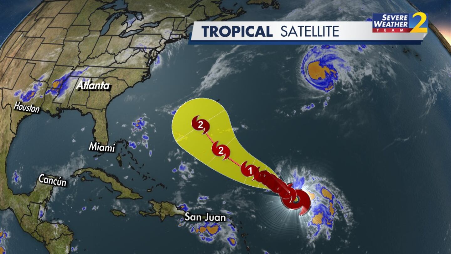
Meanwhile, Tropical Storm Humberto has formed in the western Atlantic. It will move northwest and is expected to become a hurricane by this weekend.
Closer to home, showers and storms will develop Thursday afternoon ahead of an approaching cold front.
Some of the storms especially in the afternoon and evening, could pack a punch – heavy downpours, potential strong wind gusts and isolated severe storms.
Clouds and rain will keep temperatures down to a high near 80.
A few isolated showers expected Friday, mainly early in the day, as well as Saturday.
[DOWNLOAD: Free WSB-TV News app for alerts as news breaks]
[SIGN UP: WSB-TV Daily Headlines Newsletter]
©2025 Cox Media Group


